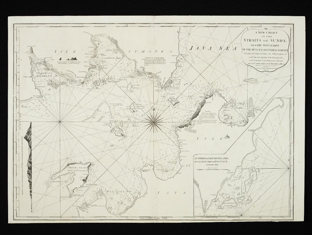
Title
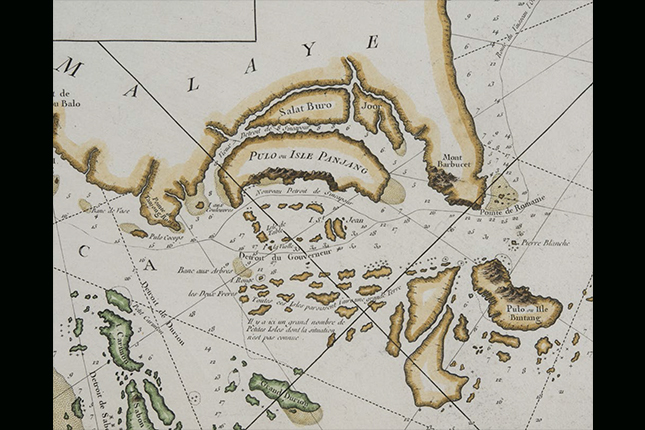
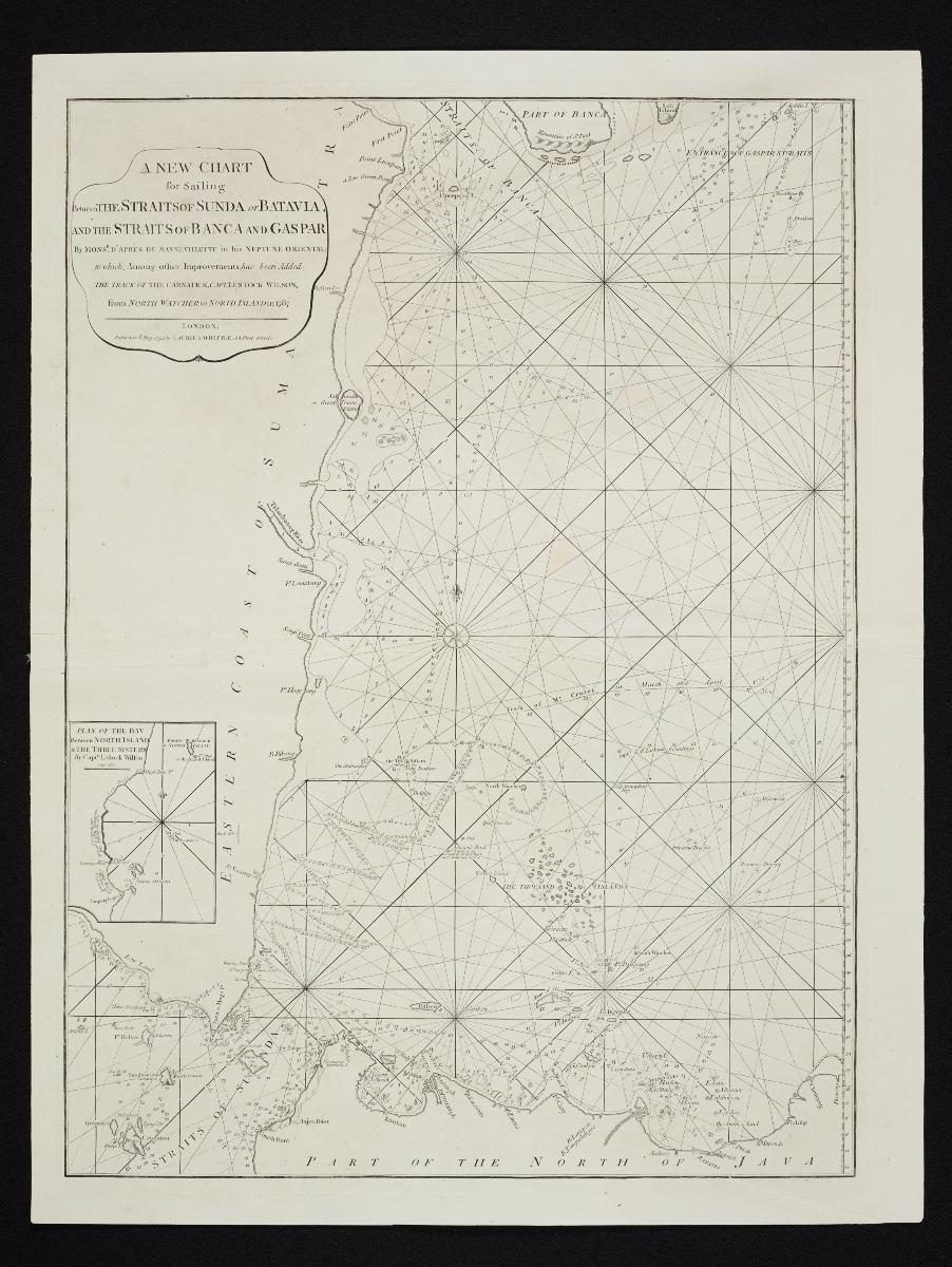
Laurie & Whittle's New Chart for Sailing between the Straits of Sunda or Batavia and the Straits of Banca and Gaspar
Year/Period
1794
Material
Technique
Dimension
Object size: 65.4 x 49.0 cm,
Image size: 71.0 x 54.4 cm
Image size: 71.0 x 54.4 cm
Accession No.
2018-00079
Collection of
This chart by Laurie & Whittle shows the Sunda Strait, an important shipping route used by the Dutch East India Company for travelling to the Moluccas, commonly referred to as the Spice Islands. The top right corner of the chart shows the entrance to the Gaspar Straits, which connected Java to the South China Sea.