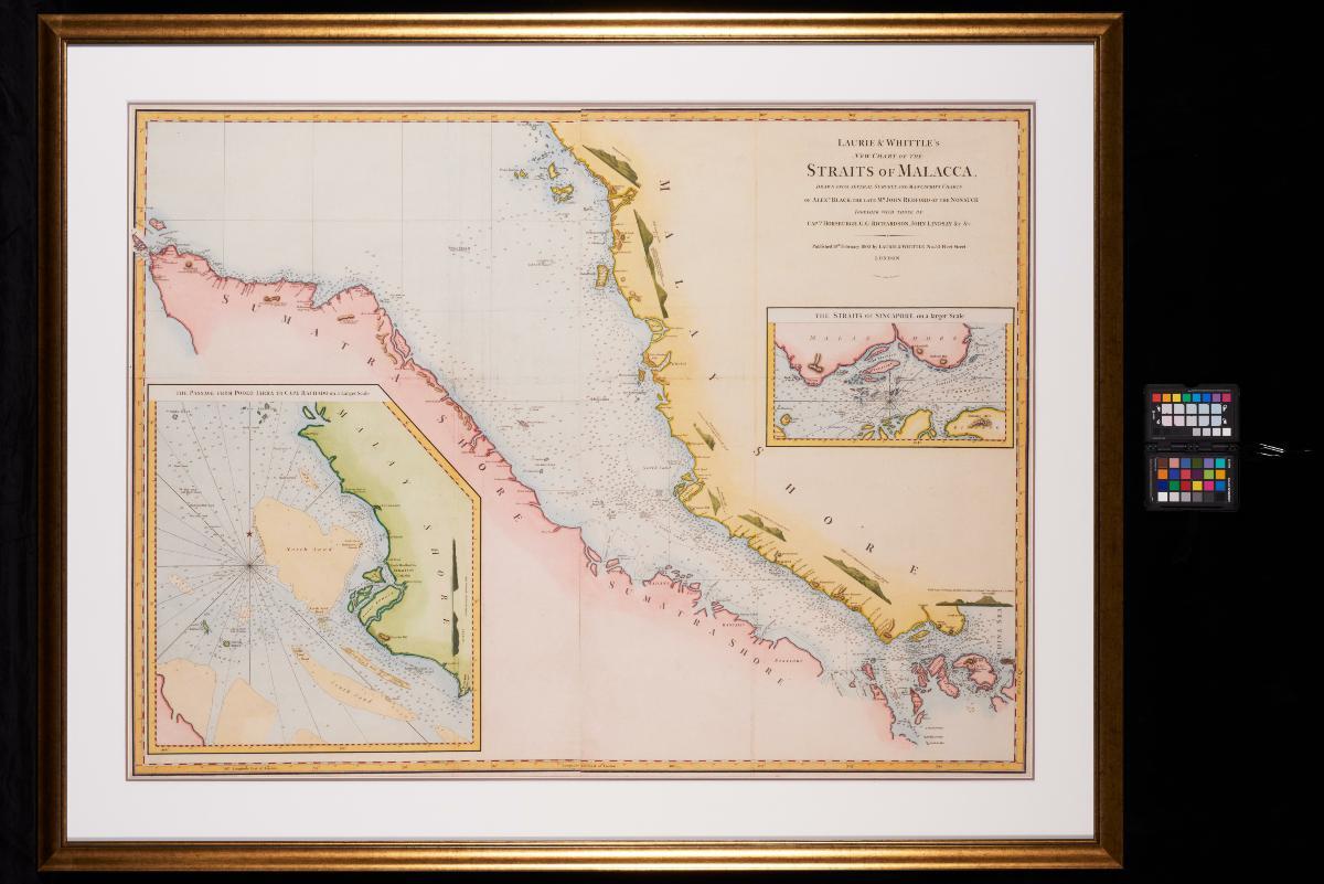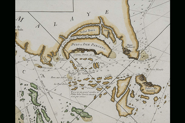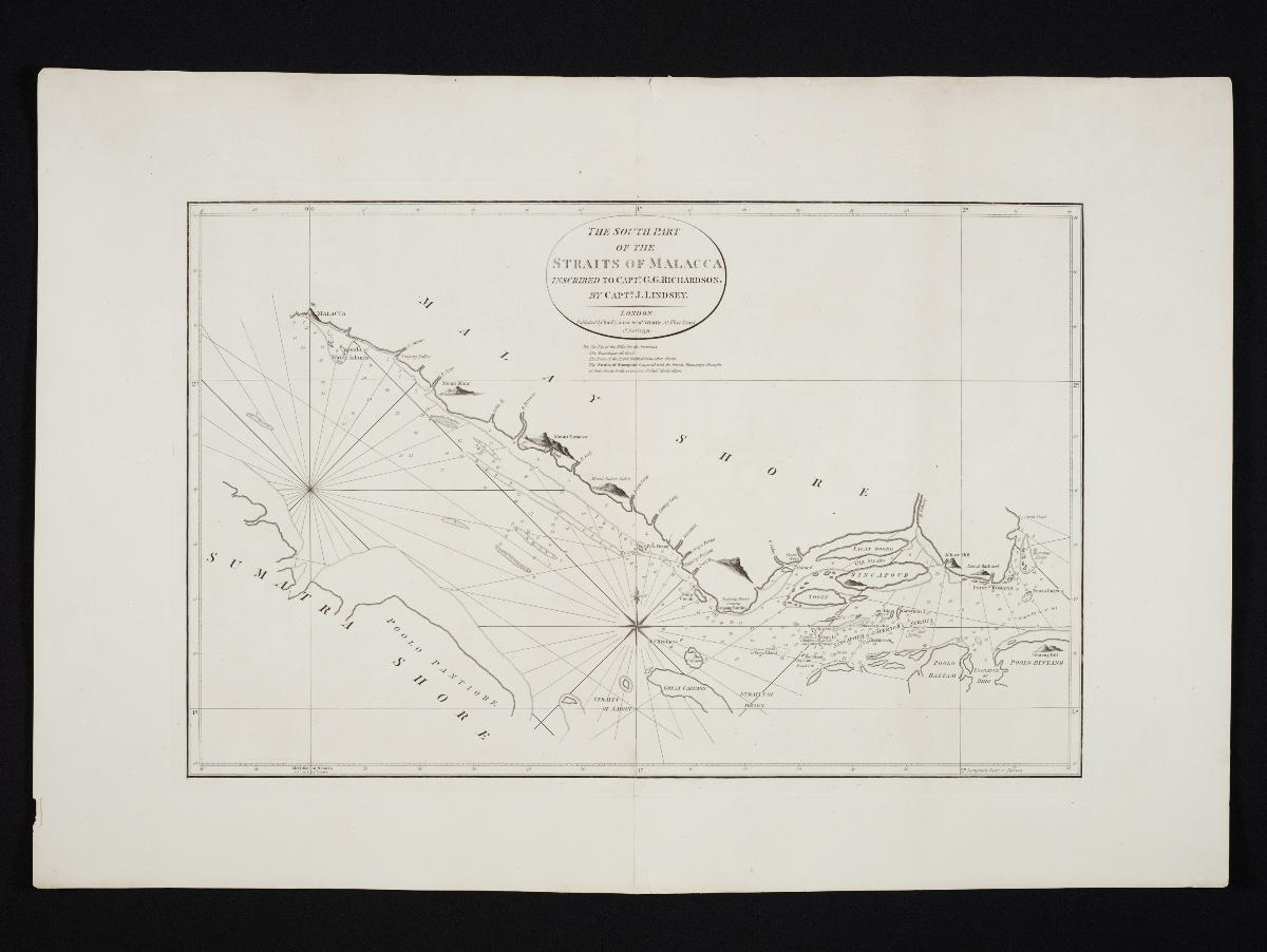
Title
Laurie & Whittle's Chart of the South Part of the Straits of Malacca
Year/Period
1798
Material
Technique
Dimension
Image size: 45.2 x 70.6 cm,
Object size: 64.2 x 94.4 cm
Object size: 64.2 x 94.4 cm
Accession No.
2018-00069
Collection of
This sea chart presents the southern tip of the Malay Peninsula, illustrating the position of Singapore island and the Straits of Singapore. The chart, printed by the English maritime publishers Laurie & Whittle, was produced by Captain John Lindsay, who indicates his preferred passage for sailing past Singapore by marking "Sincapour or Governor's Straits".