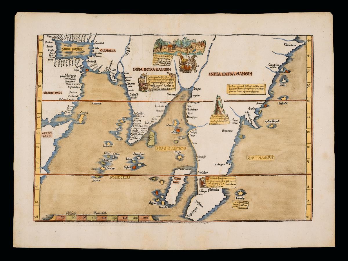
This is the 1525 edition of a map of India and Southeast Asia, produced by Strasbourg-based doctor-turned-geography editor Laurent Fries. Mainland Southeast Asia is noticeable with an illustrated entry for Mallaqua (Melaka) of a king, and a possible attempt to identify Singapura might be seen in the marking of the southernmost tip of the imagined Malay Peninsula as Bangingapara. The illustrated entries on the map are believed to have been inspired by Johannes Ruysch world map of 1507, considered one of the earliest and widely published records of Portuguese exploration into the Indian Ocean and their mapping of India and Southeast Asia; as well as the 1507 German edition of Ptolemy's world edited by Waldseemuller. It is interesting to note that at the time of this map's publication, the sultanate of Meleka had fallen to the Portuguese, and the seat of power had shifted southwards towards Johor.