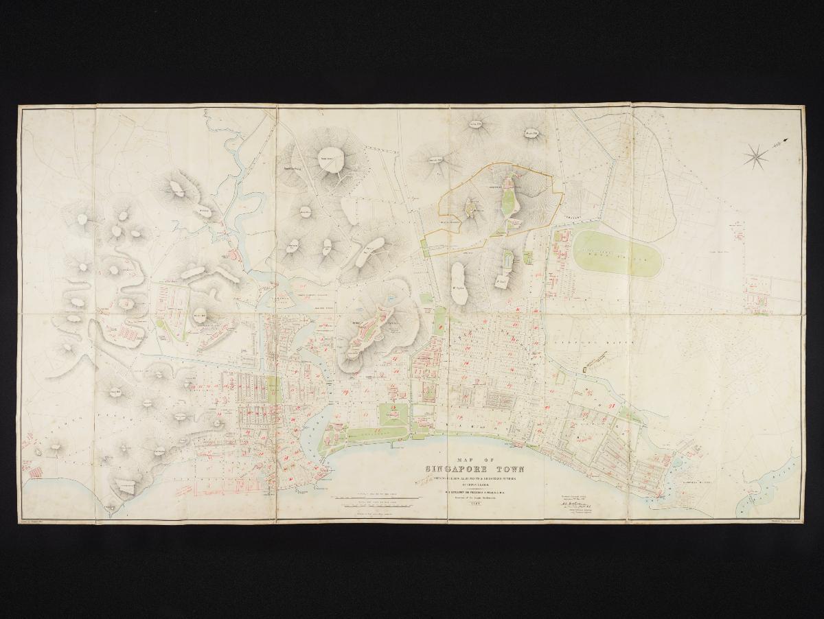
This map of Singapore town was produced by Acting Colonial Engineer H. E. McCallum in 1881. It features a highly detailed topography and building allotment of Singapore town from Tanjong Pagar to the left and Kallang to the right. Owned by Collector of Land Revenues and Registrar of Deeds H. T. Haughton, this map shows the preliminary plans for the use of the land to be reclaimed along the Telok Ayer Basin.