Title
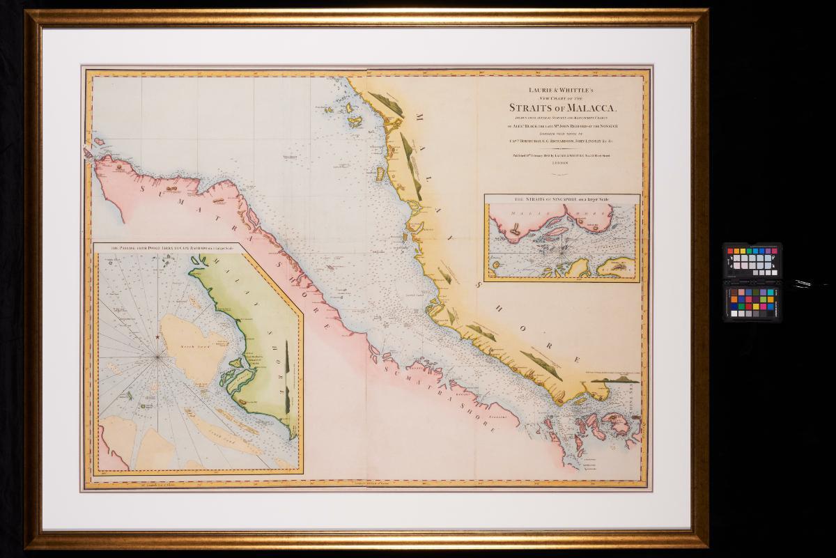
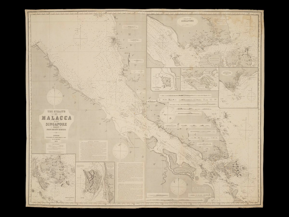
Laurie & Whittle's New Chart of the Straits of Malacca
Year/Period
1802
Region
London
Dimension
Frame size: 114.7 x 146.5 cm
Accession No.
2017-00521
Collection of
This chart was published by Laurie & Whittle, a London firm that produced maps and charts in the late 18th and early 19th centuries. It depicts the Straits of Malacca, an important trade route along the west coast of the Malay Peninsula, and includes an inset of the Straits of Singapore on a larger scale. Published in 1802, it was based on surveys and manuscripts charts by Alexander Black, James Horsburgh, G. G. Richardson and John Lindsay.

.ashx)