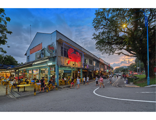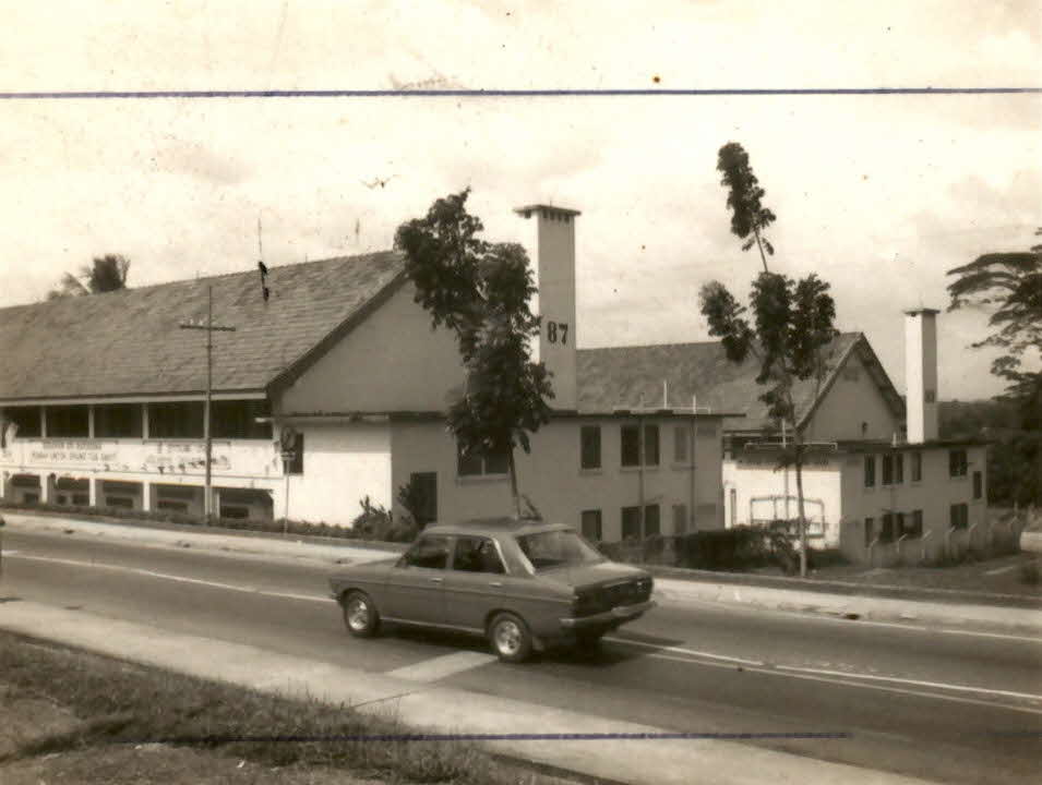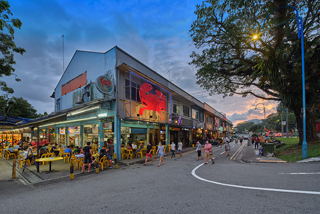
Built around 1965, this row of shophouses was popularly known as the Sembawang Strip. It was part of the former Sembawang Village, a settlement that was located along this stretch of Sembawang Road, also known as the 14th milestone of Sembawang Road.
Sembawang Village was established in the 1920s, and many of its residents made a living selling food and other goods to workers and residents of the former Sembawang Naval Base. Sembawang Village also had taxis and a bus service that allowed residents to travel all the way to the city.
After World War II, more than 20 bars opened in Sembawang Village. These bars catered to visiting sailors, who were housed in barracks within the naval base called HMS Terror (now Sembawang Camp). These sailors would visit drinking holes along the Sembawang Strip such as Nelson Bar and Ocean Bar. They also frequented an outdoor eatery next to the shops called Sembawang Patio, which was popular for dishes such as Roti John (a baguette sandwich) and sup tulang merah (red mutton bone soup).
In the late 1970s, the bars declined after the British withdrew their military forces from Singapore. In 1987, most of Sembawang Village except for these shophouses was demolished. Today, the Sembawang Strip, a reminder of the area’s naval heritage, still houses shops and eateries that continue to be popular with nearby residents.
Explore the Suggested Short Trail Routes:
- Historical Landmarks of Sembawang, 2 hours with public transport (7km)
- Communities of Sembawang, 3 hours with public transport (8km)
- From Dockyard to Shipyard, 2.5 hours with public transport (5km)
Downloads
Sembawang Heritage Trail BookletSembawang Heritage Trail Map - English
Sembawang Heritage Trail Map - Chinese
Sembawang Heritage Trail Map - Malay
Sembawang Heritage Trail Map - Tamil
Sembawang Heritage Trail Markers - Chinese
Sembawang Heritage Trail Markers - Malay
Sembawang Heritage Trail Markers - Tamil