Title
Vue et description de quelques-uns des principaux forts des hollandois dans les Indes (View and Description of Some of the Principal Dutch Forts of the Indies)
Year/Period
1720
Region
Indonesia
Object Type
Material
Technique
Dimension
Image size: 40.5 x 47.0 cm,
Object size: 40.2 x 47.0 cm
Object size: 40.2 x 47.0 cm
Accession No.
2021-00872
Collection of
Credit Line
Gift of John and Pauline Foo
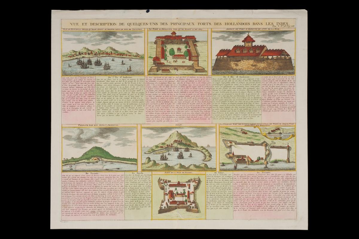
: A cartographer and publisher based in Paris, Châtelain produced a number of maps of the Southeast Asian region in his Atlas Historique, published in 1719. One of the features of Châtelain’s maps was the use of extensive descriptive annotation. This image demonstrates the overlap between cartography, topographic printmaking and written travelogues. It is not a map of the region, but instead focuses on vistas of specific forts of significance. The principal Dutch forts are shown, including the capital at Batavia, as well as the important settlement of Ternate, in the Spice Islands. Châtelain accompanies each image with accounts of the circumstances and history of each fort.


.JPG)