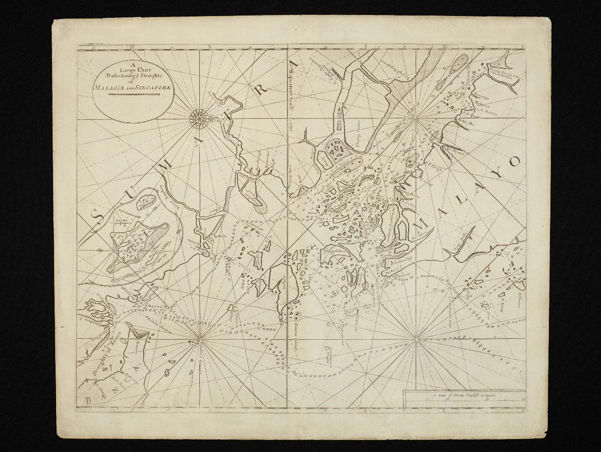
Title
Large Chart of the Straits of Malacca and Singapore
Year/Period
c1723
Object Type
navigation charts, historical maps, engravings (prints)
Material
paper (fiber product)
Technique
engraving (printing process)
Dimension
Image size: 430.0 x 53.0 cm,
Object size: 49.4 x 57.8 cm
Object size: 49.4 x 57.8 cm
Accession No.
2018-00074
Collection of
NLB Type
Map
This was the earliest English sea chart of the Straits of Malacca and Singapore. John Thornton, the official hydrographer of the British East India Company, first published this chart in 1703 in the first edition of his English Pilot, which became the main British reference for navigation in Asian waters. The next edition was published by his brother Samuel after his death, and subsequently in 1723 by Mount & Page as in this edition.