Title
Chart of the Singapore Strait
Year/Period
1870s-1880s
Region
London
Material
Paper
Dimension
Image size: 66.0 x 130.0 cm,
Frame size: 82.2 x 147.2 cm
Frame size: 82.2 x 147.2 cm
Accession No.
2016-00302
Collection of
NLB Type
Map
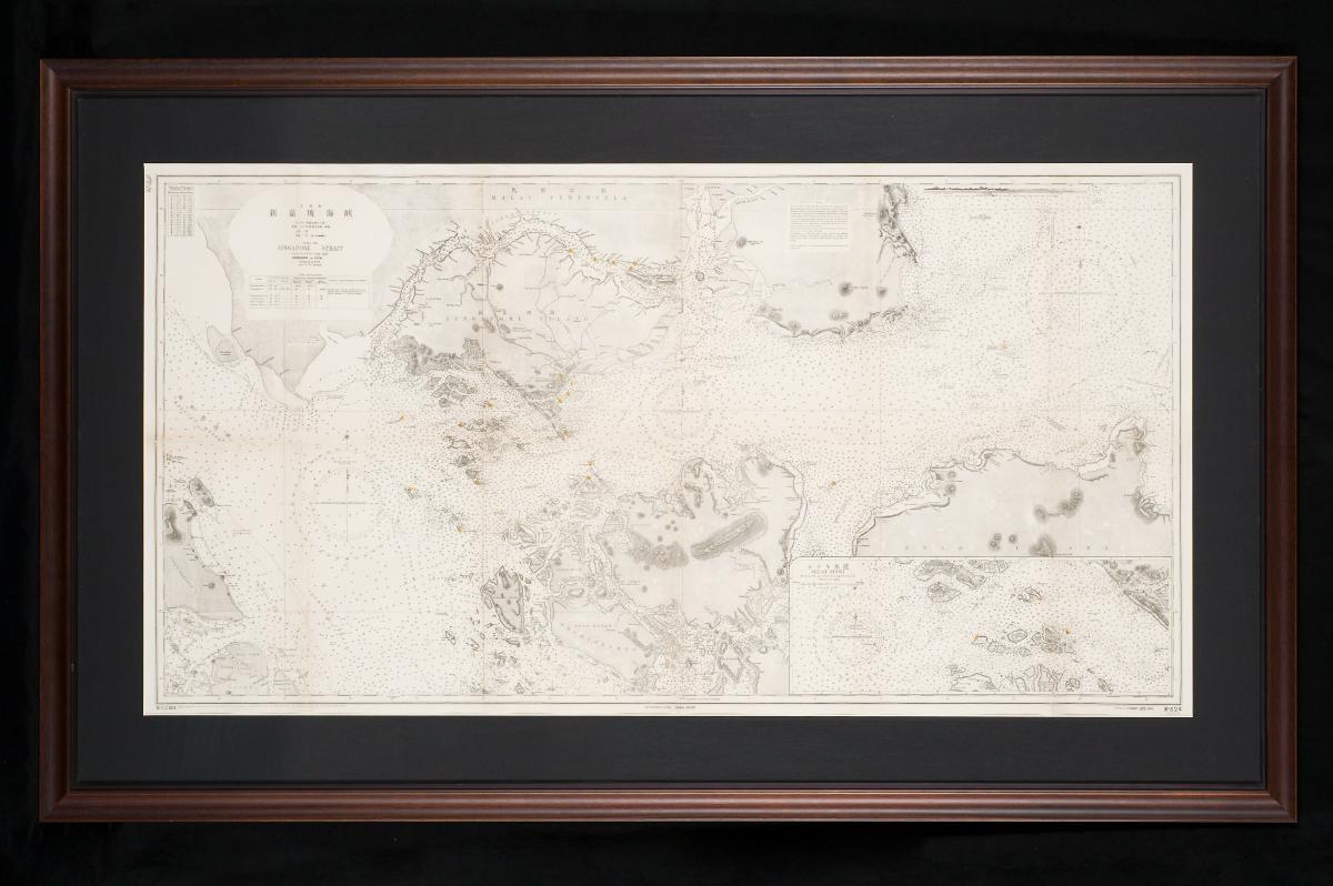
This British Admiralty sea chart of the Singapore Strait was based on a survey by Staff Commander John William Reed of the Royal Navy between 1865 and 1869. Reed was appointed to take charge of the China Sea survey for the Royal Navy in 1861 and had first arrived in Singapore in June 1862. Engraved by Davies, Bryer & Co., this chart depicts Singapore at the southern tip of the Malay Peninsula along with the islands south of it, and includes sounding details and sailing directions.