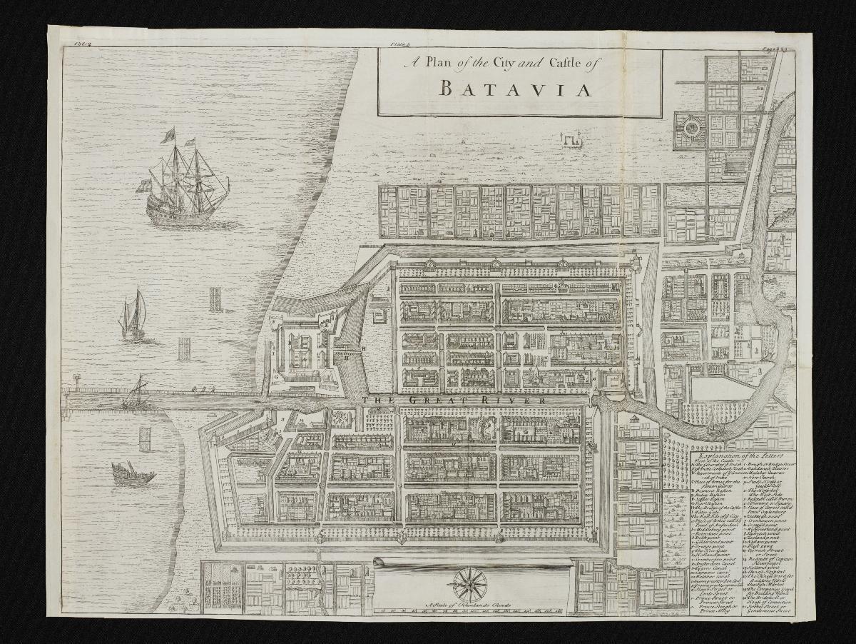
Title
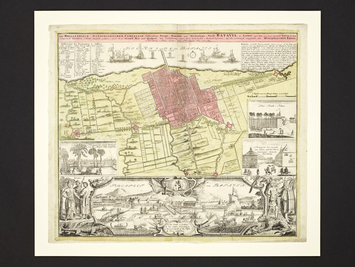
Map of Batavia
Year/Period
1733
Region
Batavia. Made in Nuremberg, Germany
Object Type
site plans, cartes à figures (maps)
Material
paper (fiber product)
Technique
engraving (printing process)
Dimension
Object size: 49 x 59 cm
Accession No.
2015-00037
Collection of
NLB Type
Map
This map of Batavia (now Jakarta), the administrative centre of the Dutch East Indies, includes several views of the city, and an impressive panoramic vista framed with native figures and wildlife. A detailed key identifies buildings and sites of importance. This information is mostly derived from the accounts and illustrations of the mid-17th century Dutch traveller Johan Nieuhof. The engraving was made by Homannischen Erben, a German map publisher.