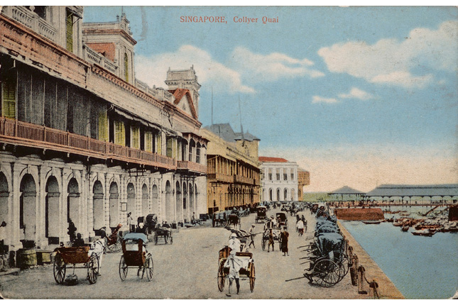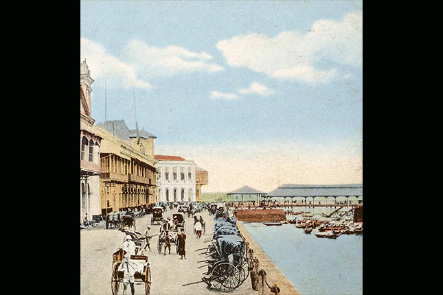
Image size: Image: H21.1 x W27.5 cm
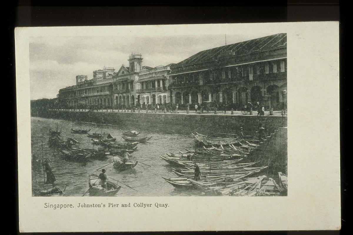
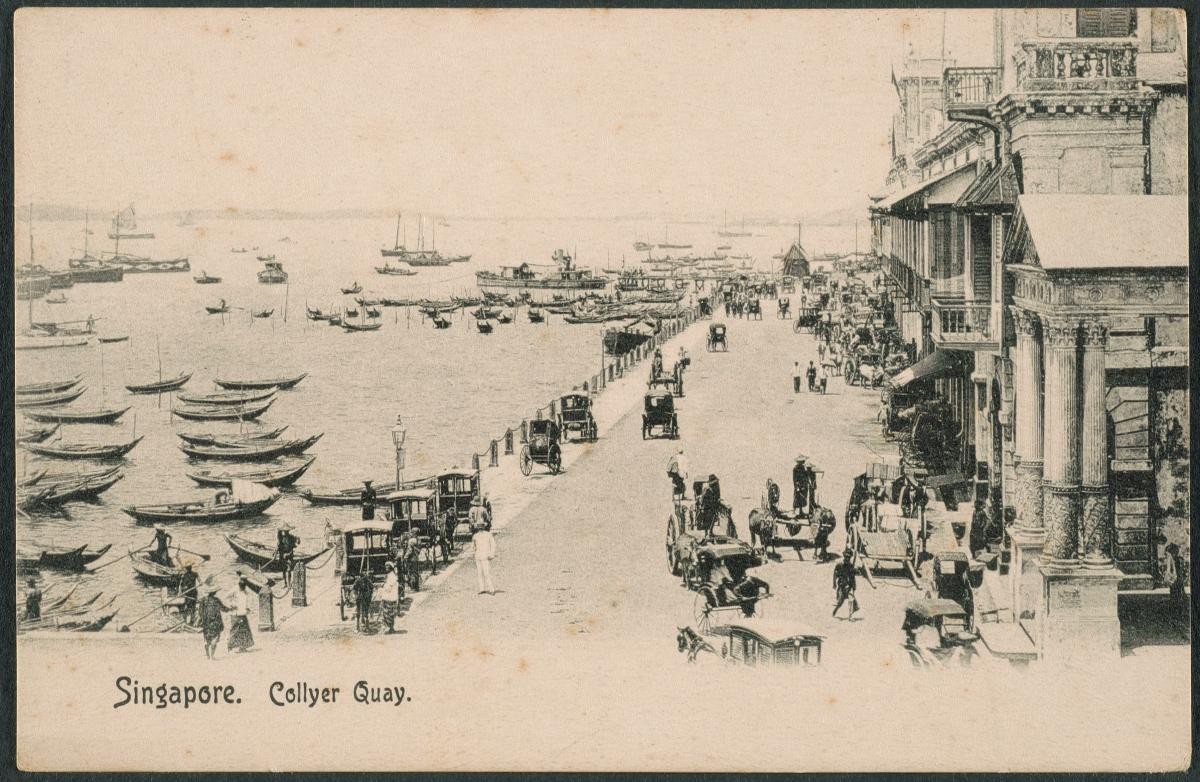
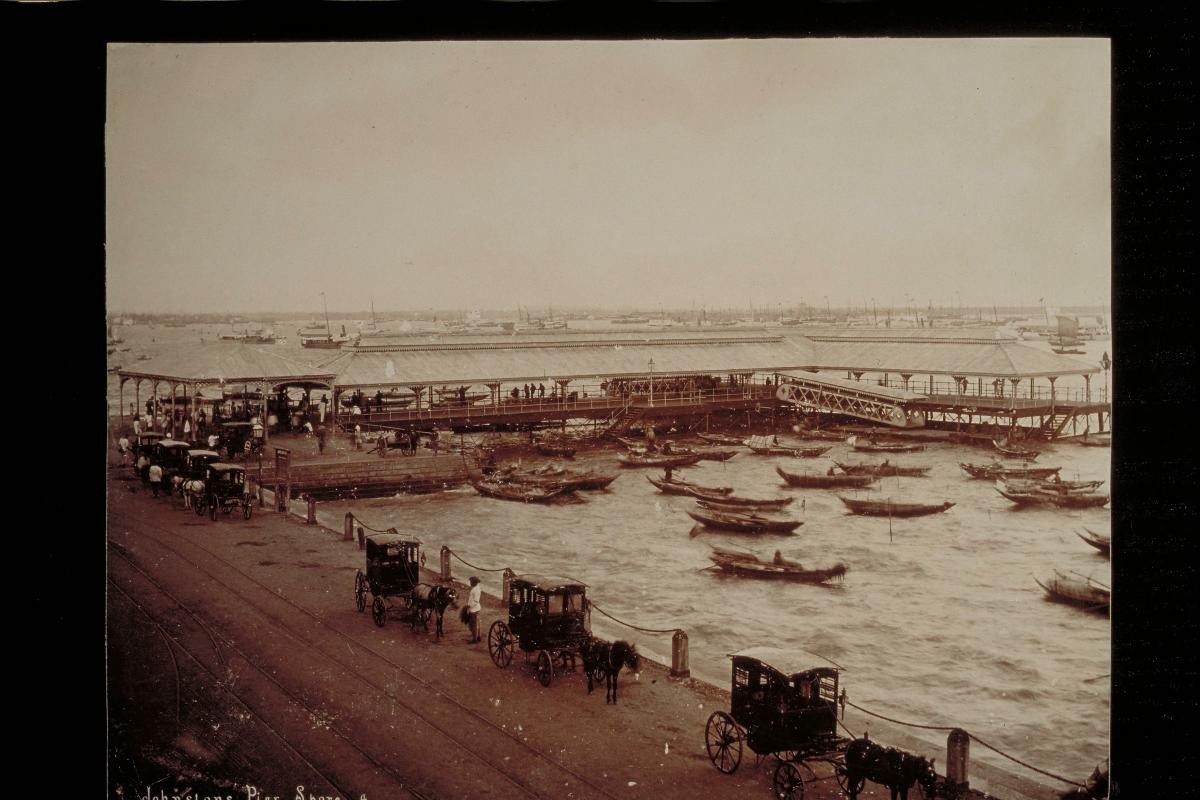
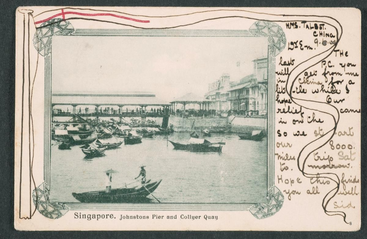
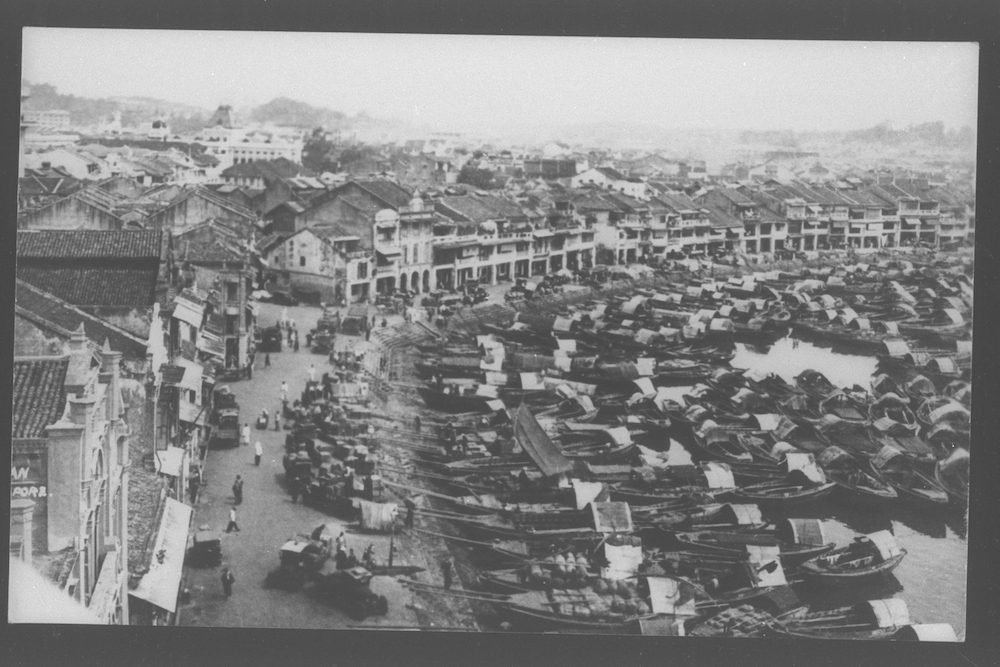
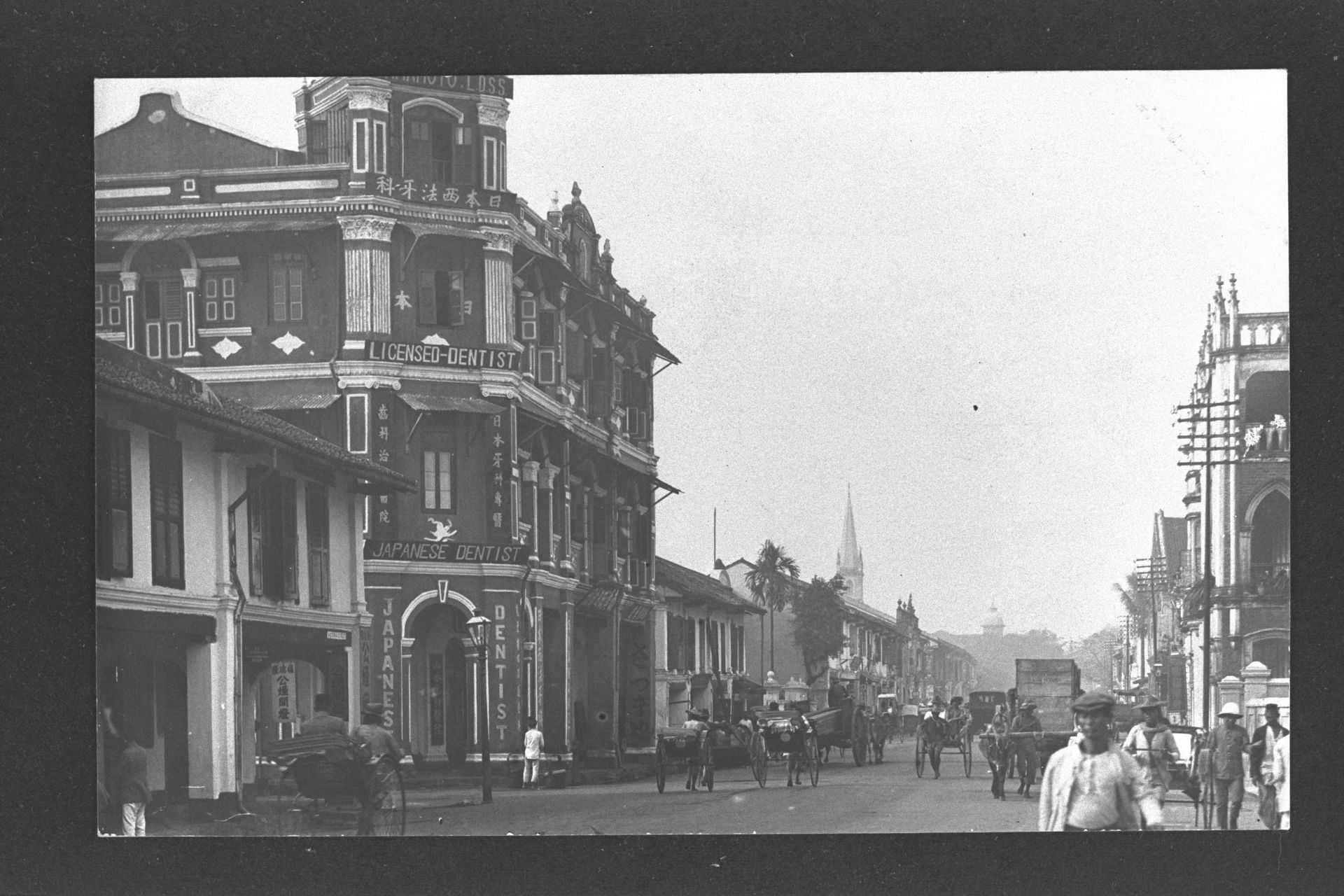
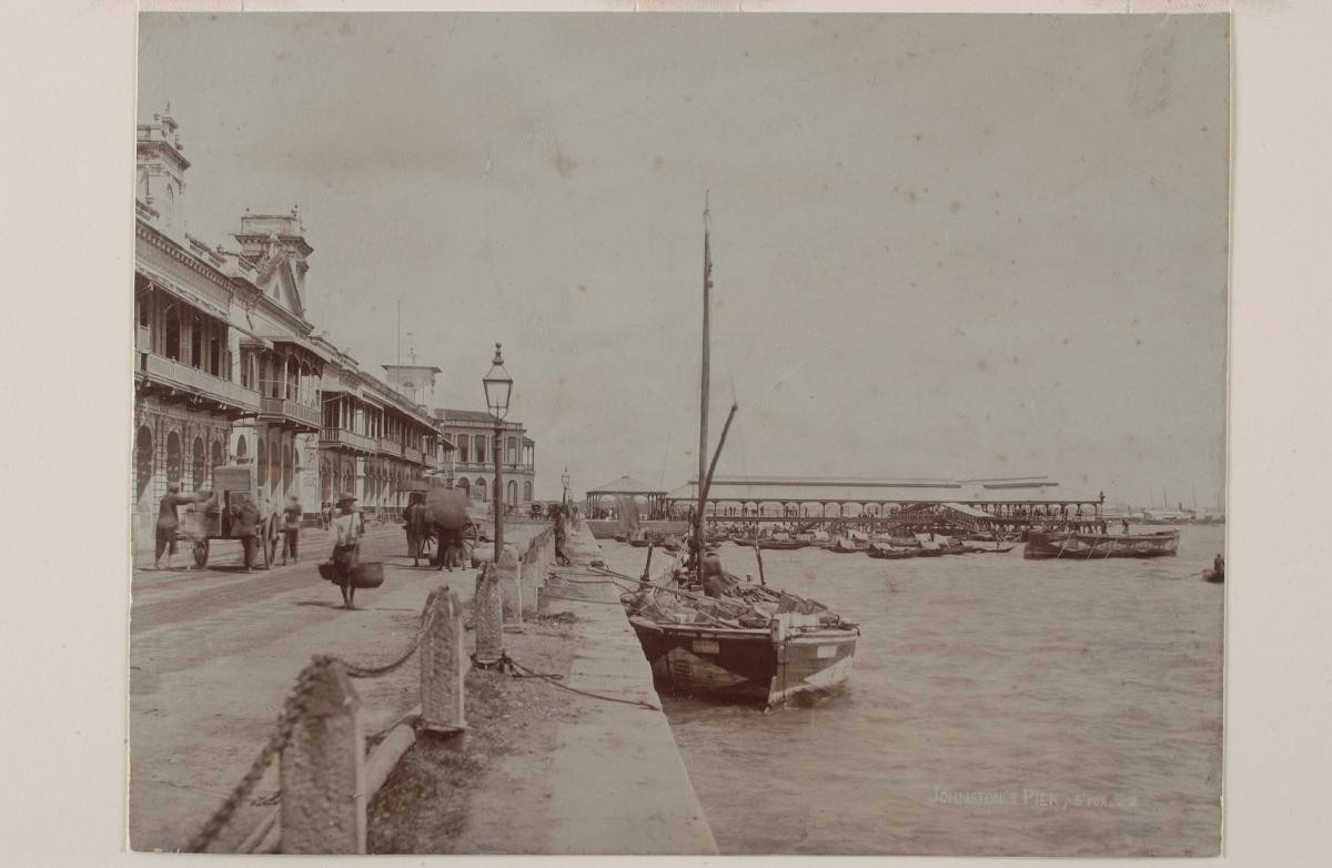
The natural shoreline of Singapore town began moving inland after 1843, with gradual land reclamation and development. The name Collyer Quay referred to a seawall built and completed by 1865 that stretched from Fort Fullerton to the old Telok Ayer market. Dubbed Collyer’s Folly, it was named after Colonel George Chancellor Collyer who was appointed Chief Engineer in 1862. About two-thirds of the seawall stretch was completed by the beginning of 1861. Earth from Mount Wallich was excavated and used to build a road next to the seawall. Land reclamation took another two years and when completed in 1864, the road was named Collyer Quay. By 1866, a whole line of buildings—known as the Merchant Offices—had been erected here, as seen here, improving the appearance of the town. Before the land was reclaimed, the buildings faced Commercial Square, and the shore was lined with outhouses and sheds.