TL;DR
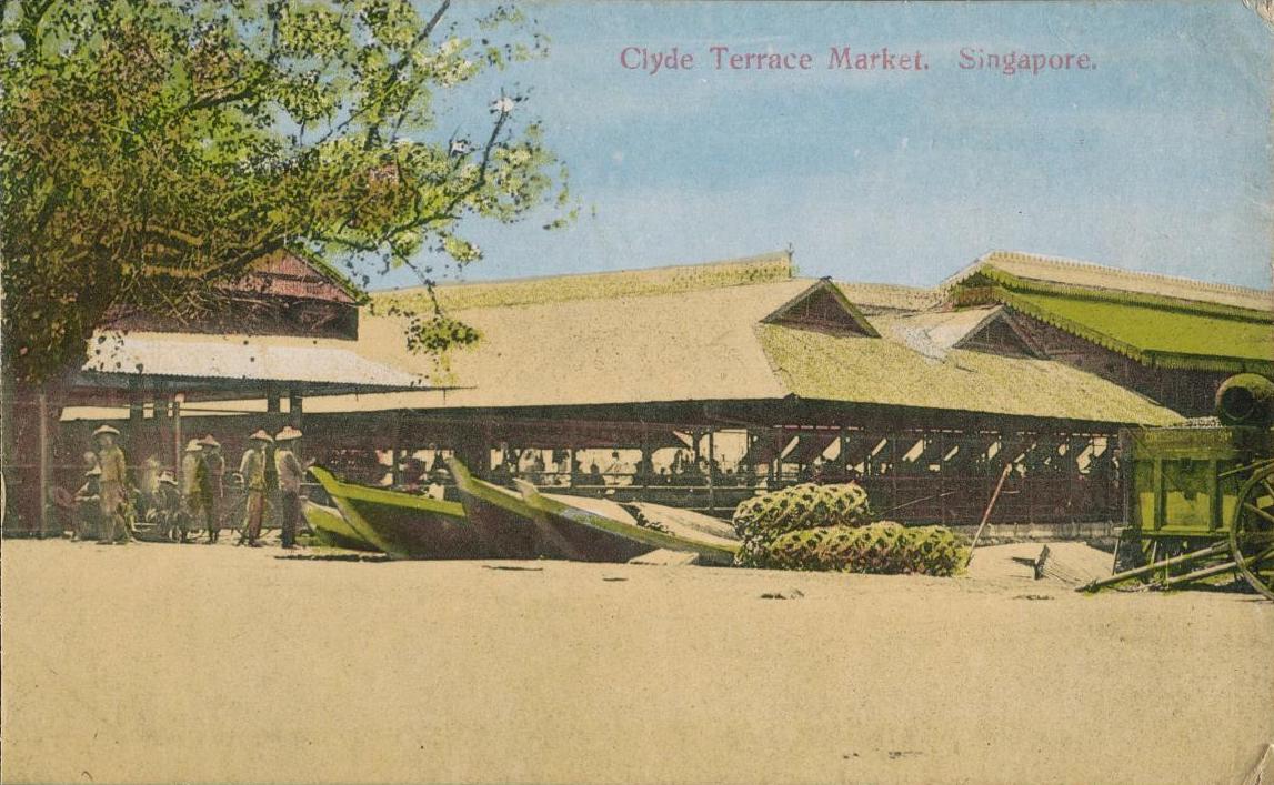
Sir Stamford Raffles landed at the Singapore River. Singapore’s early immigrants disembarked at Telok Ayer. The coastal area of Telok Blangah in the meantime, is associated with a longer history — it heralded the arrival of Palembang prince, Sang Nila Utama, who founded the island in 1299. It also played witness to other significant milestones in the Singapore story. Here’s its 700-year history in brief.
Watch: Roots.sg Presents: The Mythical Origins of Singapura
Abuzz for centuries
The Sejarah Melayu, or Malay Annals, documents the arrival of a Palembang prince called Sang Nila Utama who founded the settlement of Singapura on the island of Temasik (Temasek) around 1299. He purportedly threw his crown into the waters off Telok Blangah to keep a storm at bay.
Just a few decades later, in the 1330s, Chinese trader and traveller Wang Dayuan swung by and noted the existence of settlers1 living alongside bun-wearing, dart wielding inhabitants2 at a waterway3 between Sentosa and Labrador Point called Longyamen (Dragon's Tooth Gate).4
The Telok Blangah area was also documented as having been occupied by the Orang Laut who provided their naval prowess to Malay rulers of the region.5
Telok Blangah’s shrewd chieftain
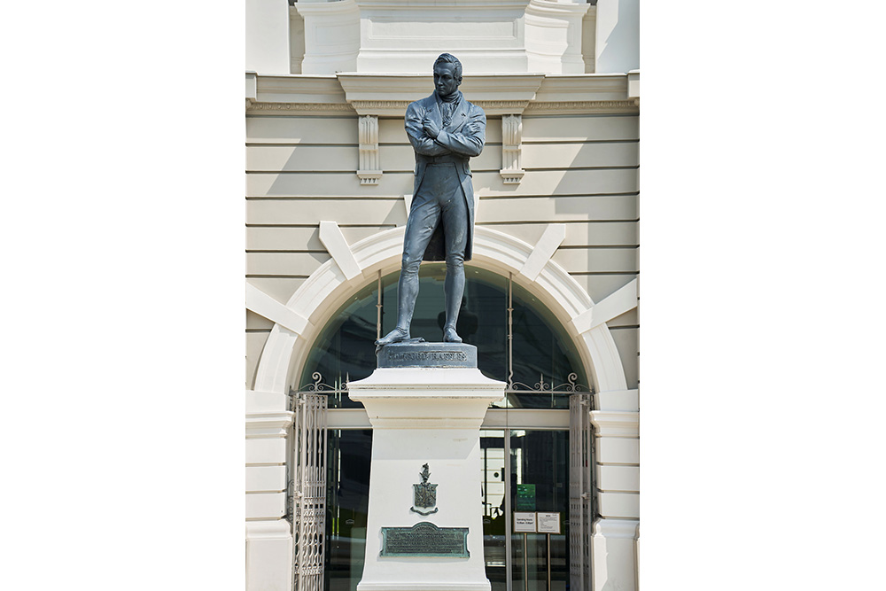
During the colonial era, Sir Stamford Raffles allocated 200 acres of land in Telok Blangah to local chieftain Temenggong Abdul Rahman and his 10,000 followers.6 The temenggong lived there in an European-style mansion known as the Istana Lama. He died in the mansion in 1825,7 having been subjected to a significant reduction in his rights, authority and sphere of influence after signing a treaty with the British the year before.8
In 1833, the Malay community appointed his son Daeng Ibrahim as his successor. Daeng Ibrahim had his heart set on restoring prestige to his family’s name and rebuilding Johor and its sultanate.9
To raise funds for this endeavour, Daeng Ibrahim capitalised on the trending gutta percha trade. The natural plastic produced by trees from the Sapotaceae family was in demand at the time for it could be used as insulation for undersea telegraph cables.10 Daeng Ibrahim was said to have engaged in piracy to monopolise the trade, much to the chagrin of the British.11
The money the chieftain earned was channelled towards the development of Johor. Telok Blangah was also given a facelift — European-style bungalows painted in green and white replaced rundown huts.12
Daeng Ibrahim, however, needed the British on his side — at the very least to acknowledge him as temenggong of Johor. To this end, he agreed to help stamp out piracy. They responded positively and had him installed in 1841.13
Daeng Ibrahim is celebrated for having the foresight to clear coastal mangroves and mudflats in the area. This land was subsequently leased to shipping company Peninsular and Orient which opened coal sheds and wharves.14
In recognition of his contributions, a mosque, which occupies the grounds of the family’s now defunct Istana Lama palace, was named after him. The mosque is co-located with a royal mausoleum housing his tomb as well as his father’s.
Both the place of worship and the royal mausoleum at 30 Telok Blangah Road are owned by the State of Johor for the Sultan of Johor.
Mount Faber’s layered past
The settlement of the aforementioned Malay chieftains lay at the foot of a rolling hill range known as Tulloh Blangah Hills.15
Over time, a number of kampungs sprung up around the ridge. Remnants of at least one such village which existed from the mid-1800s to 1980s lie along a jogging path.16
The hill underwent some changes in the mid-1840s when the British decided to establish a signal station, flagstaff and observatory, and it was also during this period that the hill was named after Charles Edward Faber of Madras Engineers. He had orchestrated the construction of a road leading to its peak. Mount Faber served as a fort from the late 1850s to 1885.17
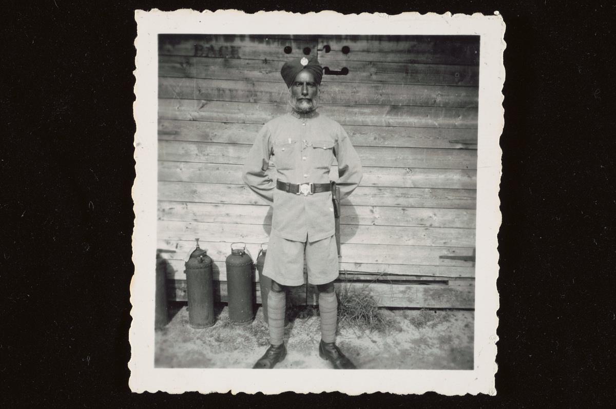 A sepoy, an Indian soldier under the employ of the British, poses for a photograph in the late 1930s along the barracks of Seletar Airbase. (Collection of the National Museum of Singapore.)
In 1905, a reservoir was built in Mount Faber’s forest as a water source for the Tanjong Pagar Dock Company — the predecessor of the Port of Singapore Authority. The body of water is about a third the size of an Olympic standard pool. It was rediscovered in 2014.18
Watch: The Forgotten Reservoir
 Tanjong Pagar Docks in the 1980s. (Collection of the National Museum of Singapore.)
In 1965, the Singapore government transformed Mount Faber into a park for locals and tourists alike. It remains popular today for its sweeping views of Singapore’s southwestern coast and southern islands, as well as the Indonesian archipelago. Visitors can also access the neighbouring island of Sentosa via a cable car station located at its peak.
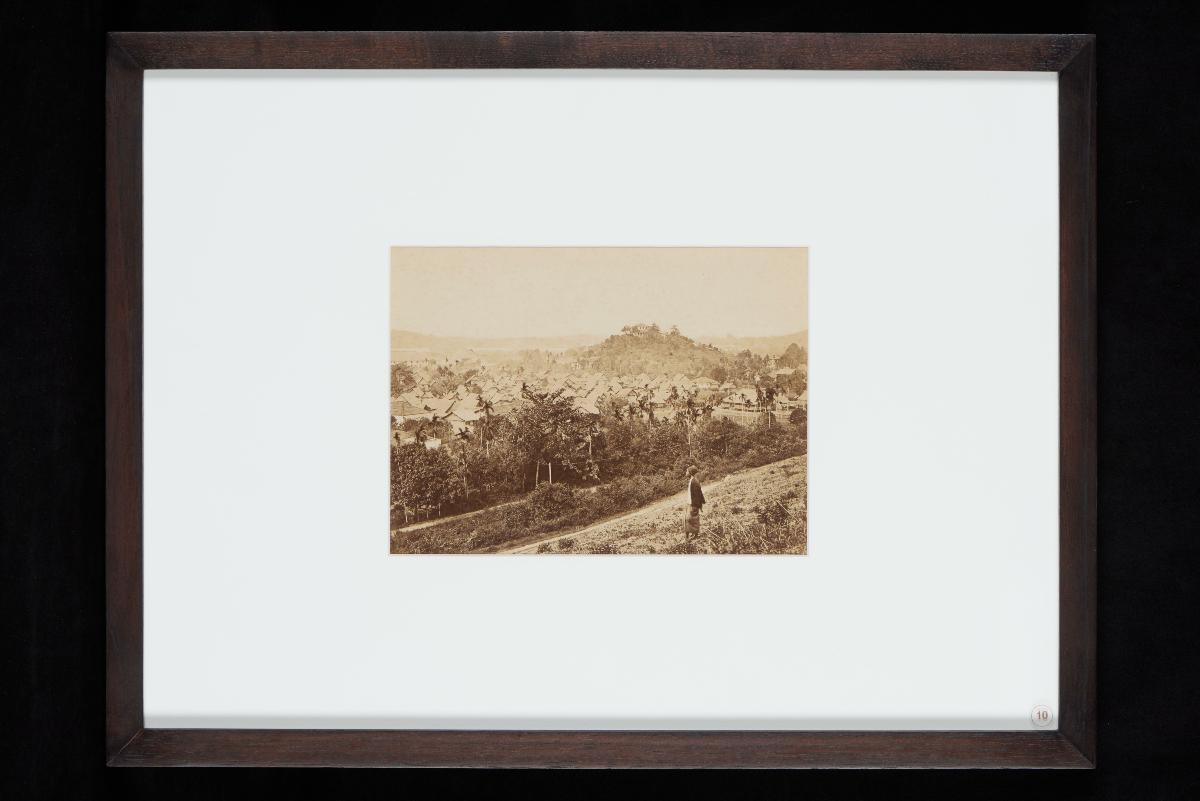
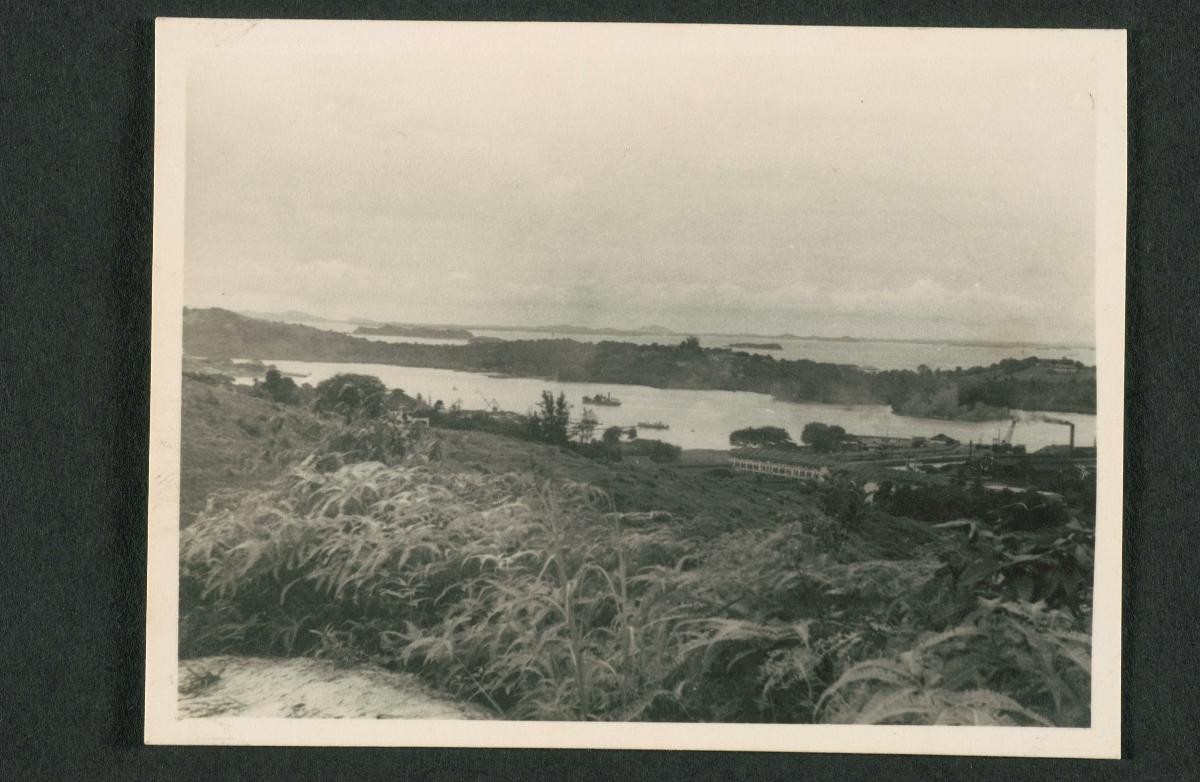
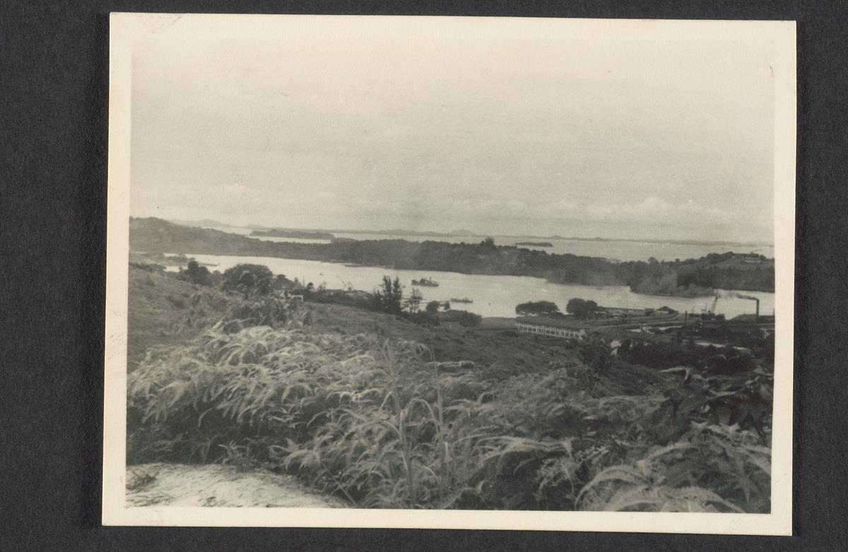 View from Mount Faber as captured some time between the 1920s and 1950s. (Collection of the National Museum of Singapore.)
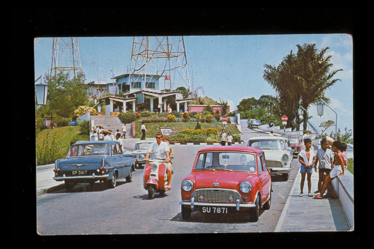 Mount Faber Hill as photographed some time between the 1960s and late 1990s. (Collection of the National Museum of Singapore.)
For a journey further back in time, visitors can stop by 10 Mount Faber Road where the shrine of Radin Mas lies. The legendary Javanese princesswas said to have lived in a village in Telok Blangah. Her shrine stands as a reminder of a time when Singapore fell under the ambit of the Javanese Majapahit empire (1293-1527).
Labrador Park’s historical landmarks
Labrador Park houses multiple structures which serve as reminders of the area’s 700-year history.
Take for instance, a pair of nondescript brick walls which flank an oft-used path. The 1886 remnants of Singapore’s colonial military past lead up to Labrador Battery. The park’s various installations, which include gun emplacements and tunnels, failed to keep the Japanese army at bay during World War II.
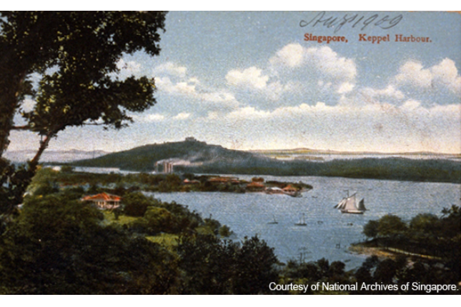
 Keppel Harbour, a thriving maritime gateway for international trade since the late 19th century. (Image courtesy of the National Archives of Singapore)
Within Labrador Park also stands a replica of the Longyamen granite rock formation which Wang Dayuan encountered in his 1330s travels to the region.18
In addition, the park is home to a navigational structure known as the Belayer Beacon.
Notes
- Biblioasia. Tales of the Dragon’s Tooth Strait
- The Straits Times. Singapore Bicentennial. Published: May 25, 2019.
- Biblioasia. Tales of the Dragon’s Tooth Strait
- Wang Dayuan, 1349.
- https://www.straitstimes.com/singapore/a-walk-down-spore-history
- As of 1824.
- Infopedia. 1824 Treaty of Friendship and Alliance
- Infopedia. 1824 Treaty of Friendship and Alliance
- Prince of Pirates: The Temenggongs and the Development of Johor and Singapore, 1784-1885. By Carl A. Trocki. pp. 86. The temenggong was... “faced with the task of rebuilding the family's political prestige”.
- Gutta percha
- Prince of Pirates: The Temenggongs and the Development of Johor and Singapore, 1784-1885. By Carl A. Trocki. pp. 86-88. According to the Chamber of Commerce, the temenggong had been systematically monopolising the traffic in gutta-percha coming to Singapore. The annual trade amounted to between $150,000 to $200,000 which the temenggong was said to have controlled about ninety per cent of this.
- Prince of Pirates: The Temenggongs and the Development of Johor and Singapore, 1784-1885. By Carl A. Trocki. pp. 88.
- Temenggung Abdul Rahman
- The Straits Times. A walk down Singapore history
- As per government surveyor John Turnbull Thomson’s 1844 map
- The Straits Times. Shedding light on history behind Telok Blangah graves
- Infopedia. Mount Faber.
- The Straits Times. Abandoned reservoir off Telok Blangah Road discovered
- Wang Dayuan, 1349.
![The History of Java, first edition [two volumes], Thomas Stamford Raffles, London, 1817](https://www.roots.gov.sg/api/media/6972aac8-d668-488a-88b7-56301f9f392a/00-cultural-connections.jpg)