Frame size: 65.0 x 79.0 cm,
Frame size: 64.3 x 79.2 x 3.0 cm,
Image size: 43.0 x 57.3 cm
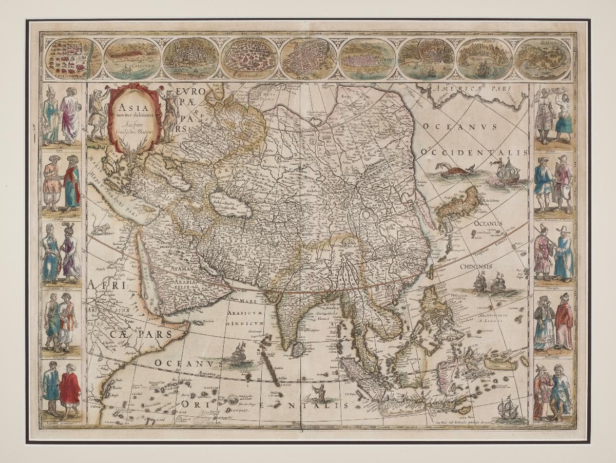
A leading Dutch cartographer, Willem Blaeu worked with his two sons to produce some of the most successful atlases of the era. Blaeu and sons also produced maps for the VOC, or Dutch East India Company. However, while the VOC tended to keep cartographic details a secret, lavishly illustrated maps were produced as luxury items for the public. Thus Blaeu also made wall maps, of a type known as the “carte à figures”, where the map was edged in vignettes of different peoples and places. This c. 1650 map of Asia is an example: as well as detailed cartographic information about Asia, the map is edged at the top with images of different port cities, including Bantam and Macao, and at the sides with pictures of “exotic” types. This type of highly-decorative map shows the interaction between mapping and other artistic genres, especially the kind of costume images that continued to be popular into the 19th century, and can later be found in other forms of media like printed book illustration and photography.