Frame size: 47.0 x 62.0 cm,
Frame size: 47.5 x 61.8 x 1.0 cm (with mount),
Image size: 36.8 x 51.5 cm
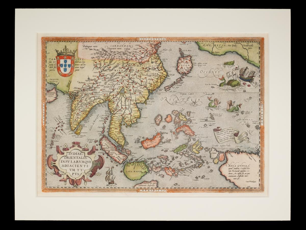
Abraham Ortelius was a 16th century Dutch cartographer and map dealer, also credited as the creator of the first modern atlas, the Theatrum Orbis Terrarum, in which this map originally appeared. This map was based on Gerard Mercator’s 1569 world map, but by combining information from different sources, Ortelius mapped the “East Indies” more accurately than previous European mapmakers. A significant detail in the map is the location of the five spice islands (Moluccas or Maluku islands). In the 16th century, Antwerp had become the leading European city of the spice trade, thus this information was particularly crucial in the period, and represented a growing engagement with the region.Elements of fantasy and whimsy, however, still appear in this map, such as the presence of mermaids and a giant sea creature toppling a galleon. Such elements increased the commercial appeal of Ortelius’ atlas among a wide audience, showing the merging of cartography and art.