Title
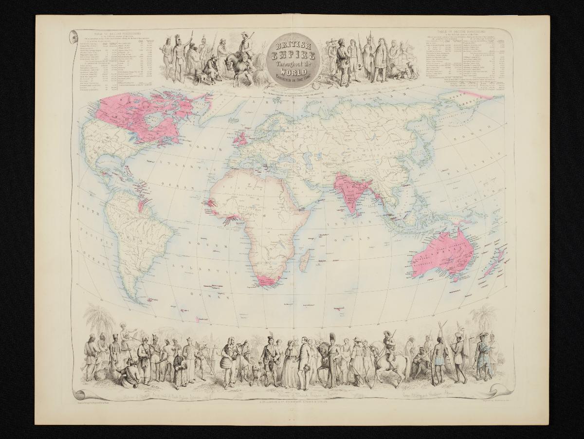
British Empire throughout the World Exhibited in One View
Year/Period
1860s
Material
Technique
Dimension
Object size: 46.5 x 58.5 cm,
Image size: 42.0 x 50.0 cm
Image size: 42.0 x 50.0 cm
Accession No.
2018-00077
Collection of
This 1860s world map was published by Archibald Fullarton as part of his Royal Illustrated Atlas of Modern Geography. It indicates British possessions in red, and contains details on the population and area in square miles of each possession. The map is also richly decorated with figures of inhabitants from these possessions, including the "natives of British Asia and of East Indian Islands" on the lower left of the map.